
Walk a Joliet Street Record
A strong street search moves from broad map facts to specific recorded documents. Begin with the legal address, not just a postal label. The assessor can supply the parcel identification number, or PIN, current owner field, situs address, tax mailing address, values, class, sale information, and legal description. Situs means the physical location of the parcel. The mailing address is where the tax bill goes and may be elsewhere. Neither field alone identifies every occupant.
Once the parcel is fixed, the recorder index can connect the current name to older deeds, mortgages, liens, and plats. A voter-status search can verify one person when the required facts are known, but it does not produce a public block roster. Historical street sections at the library can place named householders at numbered addresses in earlier years.
- Normalize the number, street, city, and ZIP, then confirm the county.
- Search the assessor and record the PIN, owner, situs, mailing address, and legal description.
- Open GIS and inspect the parcel, nearby lots, municipality, township, and district layers.
- Use the PIN or address in the recorder index, then follow grantor and grantee names through older deeds.
- For past occupants, consult Joliet city directories by street and compare adjacent years.
Search Joliet Streets by Address
The Will County Supervisor of Assessments address search accepts a street number, street name, and optional city or town. Its official example shows that “1204” and “Logan” may be entered separately. A number-only search can expose variants, while a street-only search can browse many parcels on one road. Results come from township assessor data, so questions about a current assessment belong with that local office.
| Search control | Required | Street use |
|---|---|---|
| Street Number | No | Narrows to a house number. |
| Street | No | Supports a whole-street browse. |
| City/Town | No | Separates repeated street names. |
| PIN | No | Opens the known parcel. |
| Owner | No | Checks parcels tied to a name. |
The property portal also provides sale, subdivision, owner, property-class, and PIN routes. These help when a spelling fails or one subdivision spans postal labels.
The official form shows why partial street searches are useful.
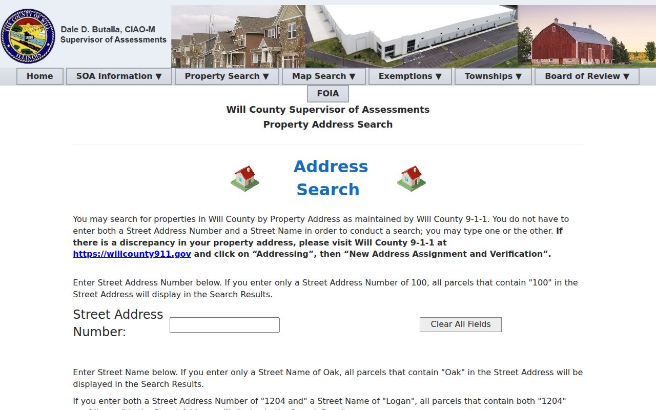
Separate number, street, and city controls permit a broad browse before an exact spelling is chosen.
Map Joliet Streets in GIS
The Will County GIS Data Viewer turns an assessor result into a block view. Identify reads features at a clicked point. Buffer selects features within a distance, while Measure checks length or area. Parcel, address-point, street, municipality, zoning, flood, township, and district layers help show which office controls an address. The county lists street and address data as weekly updates, though each layer has its own date and limits.
Will County’s vector catalogue documents the address and street datasets behind the viewer.
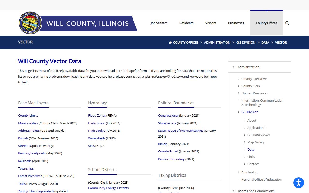
The catalogue separates street lines from address points, useful when parcel boundaries and mailing labels do not align.
Insider tip. Use Identify for one parcel, then Buffer for nearby lots, and record the layer date before relying on the map.
Joliet Records Keyed by Street
Each source answers a different question. The Joliet street directory is most reliable when those answers stay separate and are then compared. Property records point to ownership and taxation. Recorded instruments show transfers or claims. Permits show work tied to a site. Historic directories name listed householders at a publication date.
| Address record | Keeper | What it shows | Access |
|---|---|---|---|
| Assessment roll | Will SOA or Kendall Assessments | Owner, PIN, situs, mailing, values | Portal or office/GIS |
| Parcel map | Will or Kendall GIS | Lots, nearby parcels, boundaries | Free viewer |
| Deeds and liens | County recorder | Parties, documents, legal description | Index and counter |
| Permits | County or City | Site, applicant, work, status | Portal or FOIA |
| Historic directories | JPL and JAHM | Listed occupants and nearby numbers | Room, archive, scans |
Ownership is not occupancy. A trust, business, estate, or distant owner may appear. For past households, use the Joliet city directory collections, which document the historic shelf and gaps.
Follow Joliet Deeds by Address
The Will County Recorder search instructions distinguish free DirectSearch index data, paid Tapestry image access, subscription Laredo access, and the public archive. Online documents generally reach from 1965 forward. Older books, indexes, microfilm, and plats remain at 158 N. Scott Street or may be requested with an exact reference. Plats are stated to reach county inception in 1836. Staff can explain the system but will not conduct the research.
| DirectSearch field | Format | Street value |
|---|---|---|
| Last/Business Name | % wildcard allowed | Expands spelling variants. |
| Date range | MM/DD/YYYY | Limits an era. |
| Address | Number and street without suffix | Finds indexed site records. |
| City/ZIP | Optional filters | Separates similar addresses. |
| PIN | Full dashed number | Connects the exact parcel. |
The DirectSearch interface exposes Basic and Advanced routes.
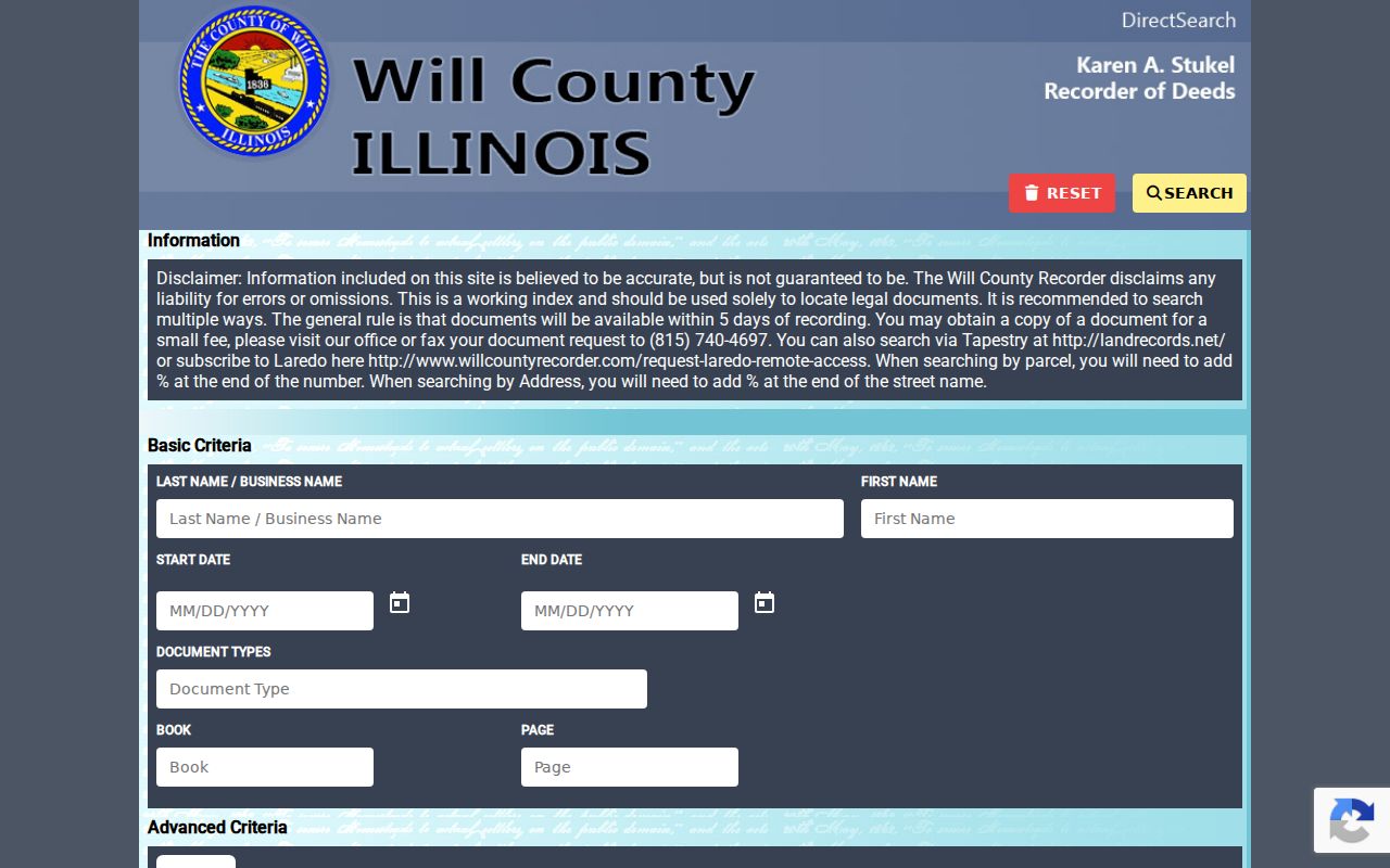
Address, ZIP, PIN, date, and name are complementary keys, not one all-purpose resident search.
Joliet Permits Along a Street
The Will County Land Use system accepts site address, PIN, owner, applicant, or contractor for county permits. The public permit search helps when a parcel card lists a structure but not the work that changed it. Within Joliet, zoning maps, subdivision records, permit forms, and City Clerk files supply the municipal layer. If a file is not posted, the Joliet FOIA process is the documented fallback, subject to Illinois FOIA exemptions.
The portal landing screen shows where an address or PIN permit search begins.
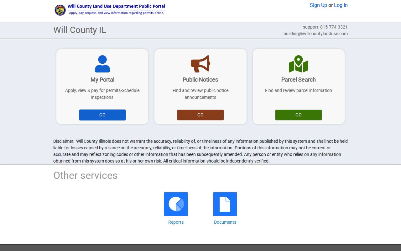
Permit evidence adds work dates and names, but it is not a complete household list.
Joliet Streets Cross County Lines
Joliet is Will County’s seat, yet part of the city extends into Kendall County. A Joliet mailing address does not guarantee a Will record. Western parcels may require Kendall County Assessments, Kendall GIS, and the Kendall Recorder. That recorder offers counter research at 502 S. Main Street in Yorkville; no equivalent stable public deed portal was located.
Resolve county through GIS layers, then use the PIN and legal description. Postal labels can also mislead. Joliet materials place Plainfield, New Lenox, and Lockport branches beside core Joliet ZIPs. Postal area, incorporated city, and county jurisdiction are different facts.
Note: A Joliet postal address can belong to Kendall County, so map the parcel before choosing a recorder or assessor.
Read Old Joliet Street Sections
Modern parcel systems do not name earlier occupants. Joliet Public Library holds city directories from 1875 to the present, while the Joliet Area Historical Museum identifies volumes from 1872 through 2002. Later Polk directories often include a street-order, or criss-cross, section. It reverses the name index by listing house numbers and occupants beneath each street.
- Parcel
- A legally described piece of land identified by a county PIN.
- Situs address
- The physical address, distinct from the tax mailing address.
- Plat
- A recorded map of lots, blocks, streets, or subdivisions.
- Criss-cross directory
- A volume arranged by street and house number.
No verified citywide Joliet renumbering year was found. Compare directory entries with 1862 and 1873 maps, Sanborn sheets from 1886, 1891, 1898, and 1924, and the recorded lot description. Nearby house numbers can anchor the right block.
Read Joliet Parcel Details
A parcel card deserves a full reading before any deed search. Besides owner and address fields, the Will County specimen contains property class, prior sale date and amount, assessed land and building values, tax bodies, subdivision, style, living area, year built, basement, garage, baths, central air, fireplace, porch, and a legal description. It also links to aerial views, GIS, and treasury information. These facts help distinguish similar addresses and test whether the selected parcel fits the building under study.
Several fields require care. The owner may be a trust, estate, company, or public body. A prior sale field is not a complete chain of title. Year built may come from assessor data that the card warns could be out of date, and pre-1912 Joliet building history has a documented gap caused by the destruction of tax and building records stored in Chicago. Check an old date against Sanborn maps, directories, surveys, and deeds.
The legal description is the durable bridge. Street numbers and postal labels can change, but a lot, block, subdivision, or metes-and-bounds description follows the land through recorded instruments. Copy that description and PIN exactly. Then compare the card with the recorder index instead of assuming that a matching surname proves the parcel.
Note: Assessment data describes a taxable parcel and building, not every person who occupies the address.
Limits of Joliet Street Records
A public owner field does not prove who lives there. Voter lookup verifies one individual with required inputs and does not provide a street roster. Utility and motor-vehicle address data are not open household lists. Deeds may show a tax address, return address, or representative. Historic directories omit unlisted people and freeze details at publication.
Illinois provides an Address Confidentiality Program under 750 ILCS 61. Eligible participants may receive a substitute address and mail forwarding, though old public records are not erased. Recorder redaction targets sensitive numbers within a document, not the whole deed. Use street records for genealogy, parcel research, civic questions, or checking a sale, and verify each claim with the custodian.
Lawful use. Joliet address records are for lawful research. Never use street or household information to stalk, harass, intimidate, or harm anyone.